Client: Town of Brookhaven
KLD was a major subcontractor to GPI on a study to develop evacuation plans in response to hurricanes and to other types of hazards for the Shirley, Mastic, and Mastic Beach areas of the Town of Brookhaven – the Mastic/Shirley Peninsula. The study area – on the south shore of Long Island – is bounded on the north by Sunrise Highway, on the east by the Forge River and on the west by the Carmen River.
Evacuation movements off the peninsula are constrained by the presence of the Long Island Railroad Montauk Branch tracks and the limited number of grade crossing opportunities available for northbound evacuees.
The primary goal of the study was to identify the types of transportation infrastructure improvements that could be planned, designed, and implemented to aid and support a mass evacuation effort. This goal was accomplished by developing a comprehensive evacuation plan through the use of a sophisticated transportation model. To properly develop the Mastic/Shirley evacuation model, traffic volumes and existing geometric features of the roadway network within the study area were collected to ensure the information implemented within the model was fully calibrated with existing highway geometric information in order to reflect current traffic operations.
The use of this computer-based simulation model in the analysis and development of this evacuation study quantified the time required for evacuation. These evacuation time estimates are affected by such variables as the scenario being considered, changes in population, adverse weather, and highway conditions.
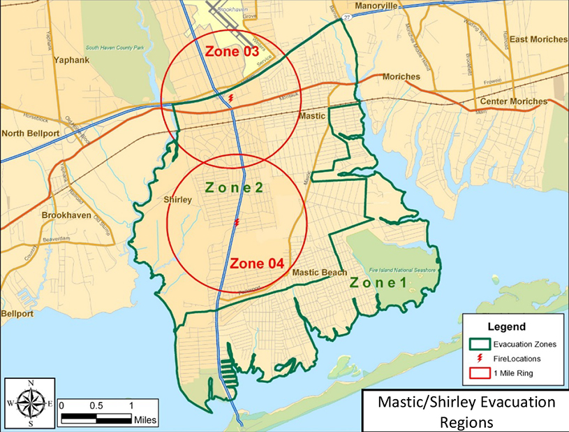
This project made extensive use of ArcGIS software to generate the required evacuation mapping. Transportation network development, identification of evacuation routes, the locations of special facilities such as schools, nursing homes, etc. all were developed using GIS software. The figure on the right presents a GIS generated map showing evacuation zones overlaid on the Shirley, Mastic, and Mastic Beach roadway network.